BIG DATA FOR
BIG PROBLEMS

By combining partner data from automotive, mapping, engineering, and robotics firms with our world-leading AIGIS platform, Allvision is able to provide ground-breaking solutions designed to build smarter cities and infrastructure.

HOW WE DO IT

Leveraging vast sets of spatial data, coupled with your own existing data-sources, our Artificial Intelligence driven enrichment platform locates and analyzes critical infrastructure assets to reveal actionable insights for you and your team.  With a full end-to-end solution for storage, augmentation, and exploration of real-world data, our ecosystem provides unique insights that give businesses and governments the ability to make informed decisions in near real-time with maximum confidence.

from vehicle capture, to digitization and enrichment, to extracted gis databases

Ingestion & Enrichment

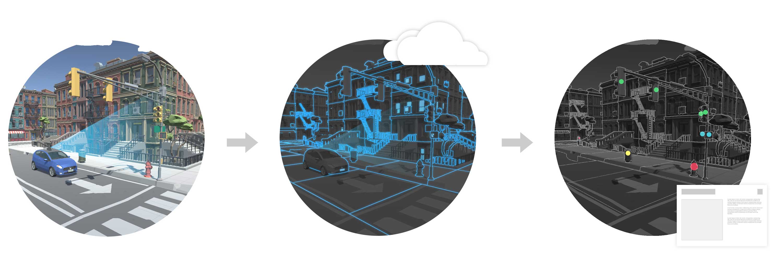
The Allvision platform ingests LiDAR, Photo/Video, GPS, other sensor data from a broad set of system providers such as RIEGL, Teledyne Optech, Topcon, Trimble, Leica Geosystems, and Velodyne. Raw datasets are processed at the edge of our cloud-based system to fuse, compress, segment, anonymize the raw data. Once in the system, datasets are merged for enrichment and analysis based on properties such as accuracy, density, and currency.

The platform analyzes and assembles datasets to extract objects and semantic information from the captured scenes. This scales via a hybrid model that combines traditional computer vision, artificial intelligence, rules-based automation, and a tactical, human-based feedback loop. These combine for an explainable, reliable system that improves over time.


Access Anywhere

Constantly up-to-date datasets, along with extracted metrics and analytics, are available via platform APIs along with our suite of cloud based front-end applications.  Accurately and cost-effectively inventory, inspect and monitor your roads, rail,  curbs, and sidewalks from any web browser.  Or, integrate our data seamlessly into existing workflows and applications. One platform, endless information!


Rates & Pricing

Data priced by the mile.  Whether you want to discover how many pedestrians your sidewalks can accommodate, determine the best curb layout for maximum parking turnover, or simply find all your signs, we have a plan that will work for you.

Request a Quote

Ready to see what Allvision can do for you?

Our automated asset identification and enrichment ecosystem provides a full end-to-end solution for storage, augmentation, and exploration of geo-spatial data.

Schedule a demo today to learn more!