Allvision AIGIS

Allvision AIGIS

Allvision now provides its AI platform capabilities as a service to those interested in streamlining and automating GIS information extraction from ground-based mobile mapping data.

The Power of AI for GIS
is Now Yours

Customers can now integrate Allvision’s AI backed GIS database and comprehensive suite of analysis and reporting tools into current workflows and custom applications. Improve the management of your infrastructure by leveraging our continually updated geospatial model, powered by a network of trusted data providers.


Ingestion & Enrichment

Why AI for GIS?

AI is a form of automation that allows repetitive tasks involving high volumes of data to be streamlined. AI is extremely helpful in GIS applications where maintaining accurate, up-to-date databases can be a tedious and time-consuming process. With the help of Allvision’s AIGIS and our machine learning (ML) framework, the creation of AI to simplify GIS data maintenance is now accessible to everyone. 

AIGIS Advantages:
  • Higher production volumes of GIS assets with the same or less labor.
  • Better consistency in results over manual workflows.
  • Continuously improve operations over time.
  • Remain competitive in an increasingly competitive GIS environment.

How it Works

AI modules are first trained and then used in production.
Data Acquisition

Source data comprised of liDAR and Panoramic imagery is uploaded by the customer or provided through Allvisions real time data-partners.

Labeling

Human resources with domain expertise label the source data to build the AI module.   After enough labels are produced, the data and labels are used to train an AI module.  This module is then “pushed” into a production environment.

AI Processing

The Processing Phase uses the AI modules on unlabeled data. After processing the unlabeled data, the resulting output labels are quality controlled through a human reinforcement process. Confidence intervals are placed on machine-produced labels allowing users to choose how much or how little they wish to review.

Deliverables

All verified results are then ready for reporting/deliverable and used to re-train the AI modules for future production. In this manner, every use of the AI module will improve it.

The AIGIS System​

At Allvision we provide you with the ability to get started with AI immediately, regardless of your team’s experience or resources. Here is the list of resources needed for training and deploying AI and how you can get started immediately.

AIGIS is a fully integrated AI framework for building and deploying AI modules on geospatial data. 

AIGIS improves with every production run, so there is no better time to start using AI for your GIS work than right now.

Training Data

If you already own miles and miles of LiDAR and imagery; great! AIGIS can start training on it today.

Don’t have existing data? No Problem. Allvision has access to a vast repository of LiDAR and imagery ready for immediate use.

Labeling and QA Services

Already have a labeling team or labeled data? AIGIS can use those labels to create an AI module immediately.

If you don’t have a labeling team yet, Allvision can provide you with labeling services with a vetted team of labeling technicians.

Bootstrapped AI Modules

Do you already have a project and don’t have the time to train a new system? Allvision can provide an existing AI module or help bootstrap a new AI module with one we have trained.

Development Services

Need Support with integrating AIGIS into your production workflow?  Allvision can provide development services and APIs for easy integration.

Contact Us

Ready to see what Allvision can do for you?

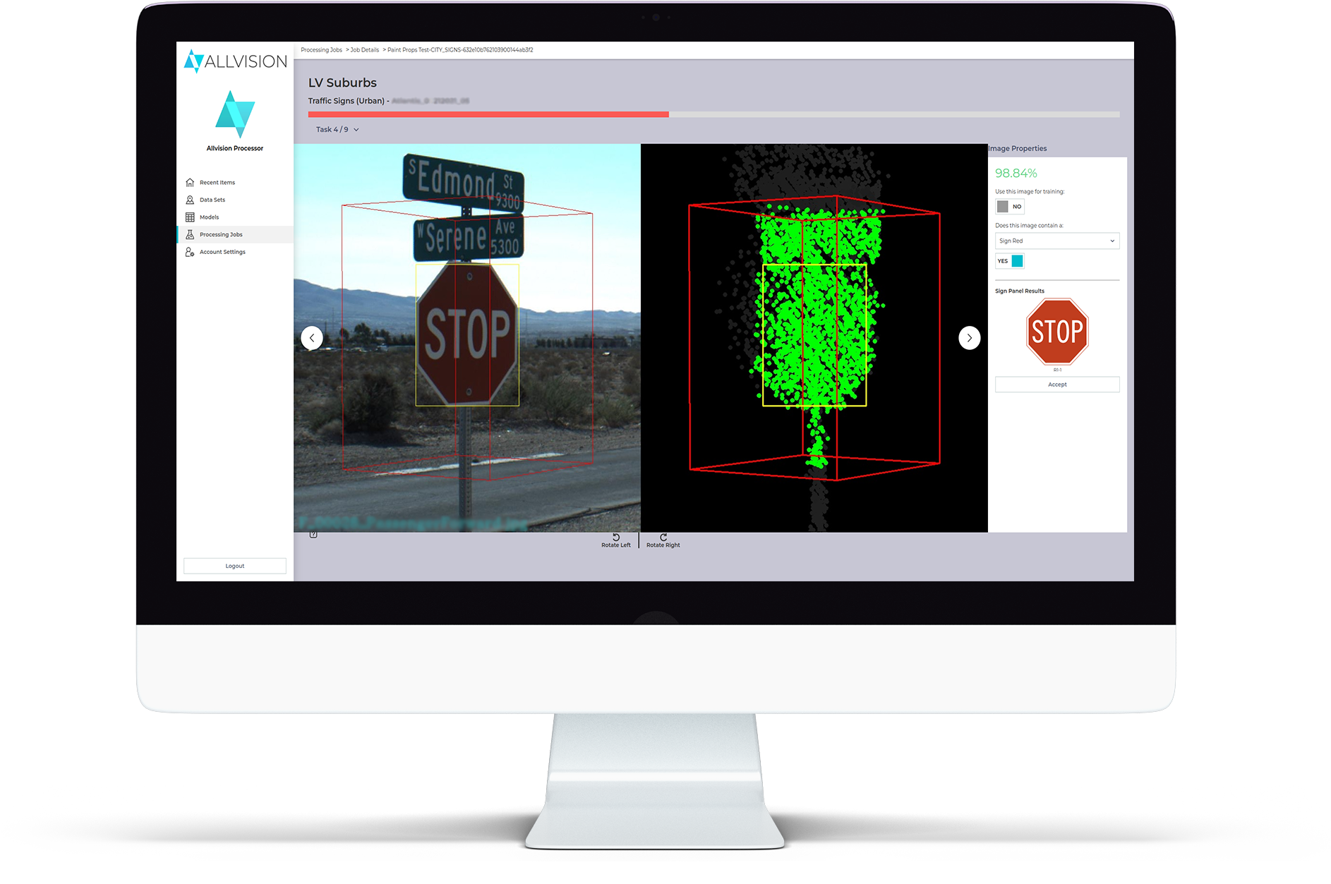
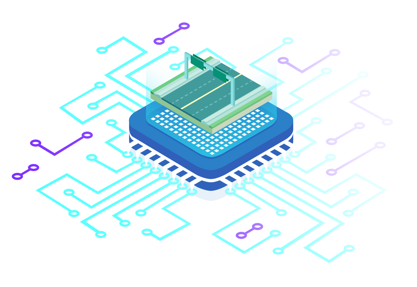
Our automated asset identification and enrichment ecosystem provides a full end-to-end solution for storage, augmentation, and exploration of geospatial data.

Schedule a consultation with us to learn more or to get started! 

Newsletter

© 2022 – Allvision IO – All Rights Reserved