URBAN
MOBILITY

Allvision helps cities, municipalities, and government agencies, and beyond to plan the reuse of the curb with incredibly fast, reliable, and accurate data, available at your fingertips.

Heartbeat of the Street

Cities, municipalities, and civic organizations are facing a growing need to increase efficiency in street, parking, and curb space for a changing social landscape. 

Planning and Development

Allvision’s data and the real-time changes that can be made as a result will directly impact the potential revenue coming into a city. Determine how many parking infractions occur in specific areas in a given period of time and by whom (delivery truck, personal vehicle, motorcycle, etc.). 

Monitor Usage and Patterns

Easily query and visualize specific metrics with our rich analytics tool-set designed to provide insights into parking behavior.  View overall usage and see how new/changing ordinance or civil engineering impact behavior.

Optimize Shared-Use Spaces

Allvision insights can quickly scale on a pass-by-pass basis to assist in determining pedestrian congestion and timebased pricing rates, determining post-quarantine use of outdoor sidewalk seating, and optimizing accessibility for micro-mobility, including scooters, bikes, and ridesharing.

Manage ADA Compliance

We can also help determine what areas are ADA accessibility compliant and which fall short, helping to future-proof citiscapes. Allvision takes your city’s information to the next generation of mobility.

Improved ROI

Invest in infrastructure wisely by making the right decisions with all the information.

Multi-Use Environments

Design more sophisticated and elegant urban landscapes by building for all modes of transit.

Regulate Infrastructure

Track infrastructure service and improvements for financial reporting

Increase Transparency

Generate positive community outreach and interaction with meaningful insights and solutions.

Benefits of Working with Allvision Curb Solutions

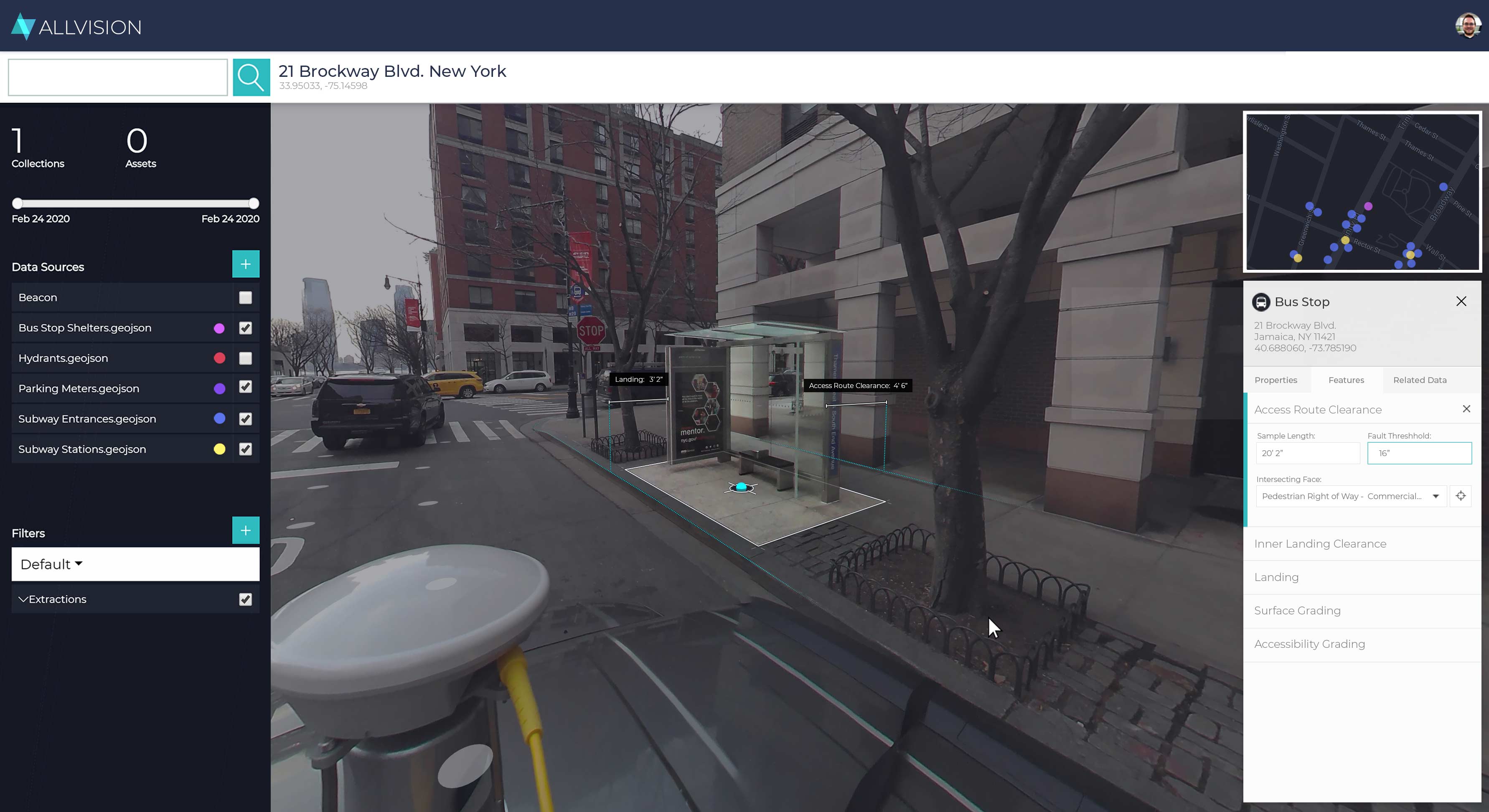
Allvision is able to provide the high definition map (we collect the data using state-of-the art sensors, or the data can be provided to us) that give insights into parking utilization over a specific timeframe. For example, where signage is located and what condition is it in, how many infractions occur in specific areas in a given period of time and by whom (delivery truck, personal vehicle, motorcycle, etc.). 


Contact Us

Ready to see what Allvision can do for you?

Our automated asset identification and enrichment ecosystem provides a full end-to-end solution for storage, augmentation, and exploration of geospatial data.

Schedule a consultation with us to learn more or to get started!