5G ROLLOUT

As part of the 5th Cohort of PGH Lab, a program that brings local entrepreneurs to beta test products and services in Pittsburgh’s local government, Allvision was tasked with locating, mapping, and categorizing a portion of the city’s 60,000 streetlight assets using reality capture and AI in three key areas, including the North Shore, South Side, and Downtown.

Allvision’s results provided city stakeholders with highly accurate information to help them make better informed budgetary, maintenance, and operational decisions, specifically for the optimization of small cell 5G antenna placement to improve the city’s network coverage.

THE CHALLENGE

Every day, decisions are being made regarding how much to budget for infrastructure maintenance. The information guiding these decisions is often collected by “feet on the street” — manpower with clipboards making notes. This information has the potential to be inconsistent, outdated, and is not always easily accessible across departments. 

The accessibility and viability of shared spaces depends on the accuracy of data gathering and the frequency of data verification. There are approximately 60,000 street lights throughout the City of Pittsburgh, many of them different sizes, heights, and made of different materials.

1
Pittsburgh Street Lights

The placement of small cell network antennas, for both 5G and densification, requires precision location with knowledge of current assets, street furniture, terrain, and existing infrastructure. Allvision’s digital twin allows users to determine potential 5G antenna locations, estimate the best fiber drops, visualize the line of sight to assets, and detect obstacles.

OUR SOLUTION

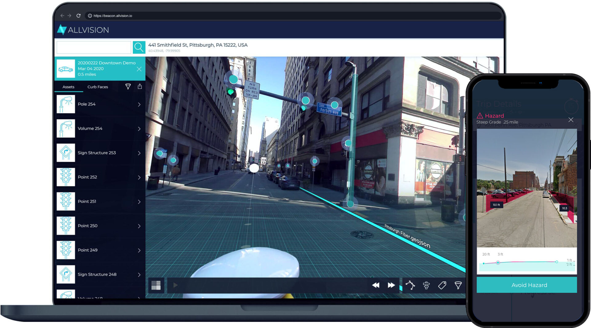
Partnering with cities, municipalities, government agencies, railways, and corporations, Allvision uses artificial intelligence to create maps of cityscapes, roadways, and curbs to help inform the decision making of these entities. Processing gathered point cloud imagery reveals parked cars, trash cans, vegetation, and in the particular case with PGH Lab, the city’s street lights. By recording the exact location and status of these important streetlight assets, Pittsburgh is better able to future-proof their processes, making informed decisions built from its in-house database.

Allvision has also partnered with the largest name in data collection and now has over a million highway miles ready to be ingested and processed for assets

Matt Jacob

Pittsburgh Enterprise Applications Administrator Department of Innovation & Performance

“The Records that we have for the street lights do not provide enough information for our current needs.”

Contact Us

Ready to see what Allvision can do for you?

Our automated asset identification and enrichment ecosystem provides a full end-to-end solution for storage, augmentation, and exploration of geospatial data.

Schedule a consultation with us to learn more or to get started!